IGN map


En parcourant ce chemin, vous découvrirez la nature de cette région sous toute sa diversité. Le patrimoine est des plus remarquables. La plupart des hameaux traversés sont superbes et sont de véritables témoins de ce qu’était un village au siècle passé. Corps de fermes, granges, pigeonniers, cabanes de berger et lavoirs sont nombreux tout au long du chemin. On aperçoit le château de Cambayrac datant extérieurement de la fin du XVIe ou du XVIIe siècle, mais il a été restauré au XIXe siècle. La ferme qui l’accompagne remonte au XVIIIe. Castanet était à l’origine, un prieuré rural. Son église Saint-Martin, autre vocable très ancien, reçut plus tard le titre «paroissiale». Au XIIe siècle, une fortification castrale avec basse-cour, le tout cerné d’un fossé, fut établi à proximité par une famille qui prit le nom du lieu et s’intitula «seigneur». Durant la guerre de Cent Ans vint s’accoler au château un fort villageois, qui dût servir aussi pendant les guerres de religion. Parcours avec 27 % de route.
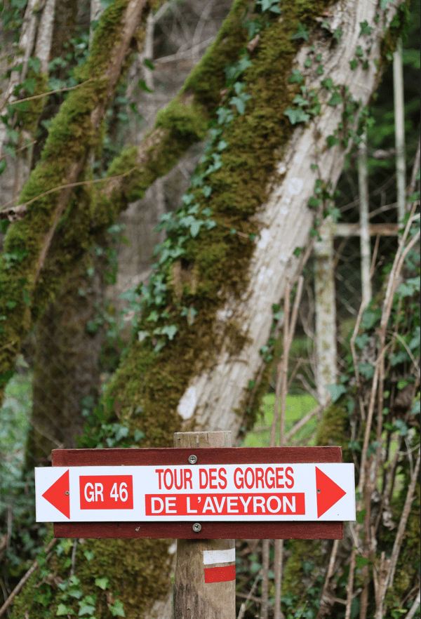
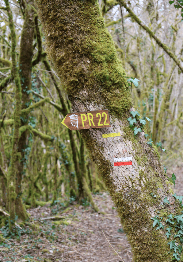
Circuit PR2 balisé en jaune
Mairie de Castanet
IGN map

Aerial photos / IGN

Slope map (IGN map)

Map 1950 / IGN

Staff map (1820-1866)

Open Street Map

Dos à la mairie, prendre à gauche. Au carrefour, poursuivre tout droit la route C3 en direction de Parisot. Après 800 m, dans le virage, s’engager sur le sentier sur la gauche. À l’intersection, prendre le chemin à droite. (Attention, glissant par temps humide).
Castanet, commune du Tarn-et-Garonne en Occitanie, se situe au nord-est du département, entre Quercy et Rouergue, dans le causse de Caylus, au sud de celui de Limogne, à un carrefour historique et culturel.
Aux origines, « Castanet dʼEscarts » est le lieu d’une très ancienne occupation humaine. Des outils retrouvés sur un site magdalénien l’attestent. Les Pierres Levées connues à Cambayrac prouvent l’occupation à l’époque du Néolithique.
Du Haut Moyen-Age il reste des sarcophages, dont un visible près de l’église de Castanet, découverts à l’emplacement de l’actuel café Castagné, à proximité de l’ancien fort. Dès le XII e siècle, la famille De Castanet possédait la seigneurie…
La commune de 2200 hectares comprend aujourd’hui deux paroisses : Castanet et son annexe Combayrac et le Cuzoul. Bien que petite, la commune n’en est pas moins animée, ses habitants sont très actifs au travers de nombreuses associations culturelles et de loisirs
La commune se partage entre ségala à l’est et plateaux calcaires à l’ouest. Le côté ségala possède le point culminant du département (504m) et est en partie couvert de châtaigneraies qui ont donné leur nom à la commune.
À la route, prendre à gauche. Après avoir franchi le pont sur le Ferran, tourner à droite. 300 m après le Mas de Maillet, virer à gauche. Au carrefour, se diriger à gauche. À l’intersection, aller tout droit. Après 200 m, continuer sur la droite. À la route, tourner à gauche. Passer Cambayrac.
Le château de Cambayrac ouvre ses portes aux vacanciers désireux de passer du temps en famille ou entre amis, en pleine nature, dans un lieu chargé d’histoire.
Autour de la tour dans laquelle un bel escalier en pierre dessert les 3 étages, retrouvez les pièces de vie en rez-de chaussée avec une cuisine aux éléments intégrés (lave-vaisselle, piano, four, micro-ondes, réfrigérateur), une salle à manger (table et 12 chaises, meubles de rangement), un salon avec fauteuils, un wc avec douche à l'italienne. Au 1er étage, inondé de lumière, le grand salon (canapé, fauteuils, TV), et une suite parentale (1 lit 160x200) avec dressing, salle de bain privative avec vasques. Wc avec lave-main indépendant. Au 2ème étage, 4 chambres dont 3 avec chacune 2 lits 0,90 x 200, et 1 chambre avec 1 lit 160 x 200. 1 salle d'eau douche à l'italienne avec vasques, 1 salle de bain avec vasques et 2 wc avec lave-mains indépendants. Au dernier étage, une immense salle de jeux salon TV grand écran, jeux, bibliothèque, une chambre avec 1 lit 160x200, grand dressing, 1 salle d'eau avec douche à l'italienne et vasques, et 1 wc avec lave-main. 2 terrasses avec salon de jardin, barbecue, meubles de repos. Espace lingerie à l'extérieur dans une dépendance exclusive au château : 2 lave-linge, sèche linge, réfrigérateur supplémentaire. 1 wc avec douche pour la piscine. Après quelques marches, la piscine 11x3 avec alarme, bien intégrée au site et ses bains de soleil tout autour. Linge de lit de toilette et de maison fournis et compris dans le prix. Wifi dans le château. Boules de pétanque, table de ping-pong, badminton et Mölkky. 3 hectares de bois vous offrent aussi de belles balades à découvrir.
www.chateaucambayrac.com/
Traverser la D84, prendre le chemin en face. Continuer tout droit jusqu’à Causseviel, poursuivre tous droit en traversant le hameau puis emprunter le chemin empierré sur 900 m. A l’intersection, continuer en face après 40 m prendre à gauche. Suivre la voie principale sur 1 km. Avant Pailhas, bifurquer à gauche sur un sentier bordé de murets.
Traverser la route et poursuivre en face du sentier. À l’intersection, tourner à gauche. Descendre jusqu’à la croisée de chemins juste après le virage (glissant par temps humide). Virer à droite. Suivre le sentier ; après la digue, franchir le pont de la Baye.
Après la montée, tourner à gauche puis à nouveau à gauche. Prendre le chemin principal. Rejoindre la route, continuer tout droit sur le sentier en passant devant une chapelle en ruine près du cimetière. Après 250 m, le chemin oblique à droite. À la petite route, suivre à gauche sur 30 m.
A l’entrée du Mas de Bringou, suivre à gauche le chemin de terre qui descend vers la Baye sur 400 m, puis tourner à droite. Après avoir traversé le pré, au croisement de sentiers bordés de murets bufirquer à droite et continuer tout droit sur le chemin .Au bout 150 m, tourner à droite et monter jusqu’à La Meune.
À la route, tourner à gauche et la suivre jusqu’au Mas de Bonnet. Au carrefour, au niveau du lavoir, prendre à gauche. À la sortie du Mas del Sol, prendre le chemin à droite après la maison en ruine. Passer Fontfrèche et poursuivre jusqu’à la D84. Tourner à gauche.
Après 400 m, tourner à droite sur un chemin herbeux. À l’intersection, tourner à gauche, descendre la vallée puis suivre la voie principale qui remonte jusqu’à La Pialle.
Continuer sur votre gauche. Au calvaire, prendre le chemin à gauche. Poursuivre tout droit sur 500 m. Après avoir traversé le second ru, emprunter le chemin qui monte sur la droite. À l’intersection, s’engager à droite. Suivre ce chemin jusqu’au Pech. Traverser la route et prendre le chemin à gauche qui passe entre les maisons. À la bifurcation, partir à gauche puis à droite.
Rejoindre la D75 et tourner à droite à l’intersection. Après 200 m, poursuivre tout droit le chemin. Rejoindre la route, obliquer à gauche. Après 200 m, au niveau de Reynou, suivre le sentier qui mène à la place du village. Tourner à droite puis à gauche pour revenir au point de départ.