IGN map


Cette randonnée comporte peu de portions sur route. Toutefois, elle est longue et assez ensoleillée, pour cette raison, nous la conseillons aux bons marcheurs. La faune est riche et peut-être apercevrez-vous un chevreuil ou un gros lézard vert qui peuple le Causse. Randonnée idéale pour découvrir la flore du Causse. Vous alternerez entre prairies, landes et sous-bois. Dans les combes précédant Gagne-Po (Ganha pan : gagne pain), le chemin serpente sous des tonnelles de buis, offrant un instant rafraîchissant au promeneur randonnant en été. A Caylus, la place de la Halle avec les façades et les toitures des immeubles qui la bordent fut classée aux Sites Inscrits. La Halle devint Monument Historique le 16 février 1900. Par la structure et la forme de ses piliers, la Halle appartient à la fin du XVe siècle, début du XVIe. Construite en 1505, primitivement située sur le côté opposé de la place, elle ne comptait que quatorze piliers. Elle a été déplacée et agrandie en 1905.
Route with 20% of road.
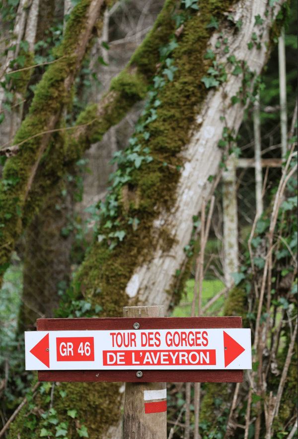
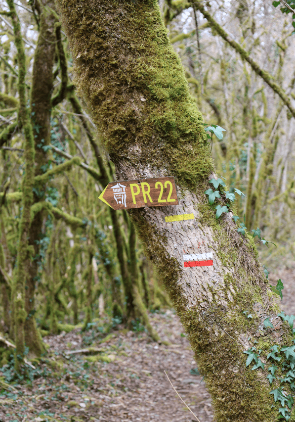
Circuit PR6 Caylus balisé en jaune
Place de la Halle
IGN map

Aerial photos / IGN

Slope map (IGN map)

Map 1950 / IGN

Staff map (1820-1866)

Open Street Map

Départ place de la Halle. Dos à la halle, se diriger à gauche, traverser la D926, avenue du Père Évariste Huc. Prendre à droite l’escalier puis à nouveau à droite le chemin du Marquisat. Après un lacet à gauche, à la bifurcation, continuer tout droit la montée. Au croisement, tourner à gauche. Passer devant le point de vue de la Croix offrant une vue de Caylus et des collines du Rouergue. Continuer en direction de la D926.
Une cité médiévale dans un écrin de verdure ! Site pittoresque du Sud-Ouest dans la Vallée de la Bonnette, Caylus constitue un véritable carrefour.
Une cité médiévale dans un écrin de verdure ! Site pittoresque du Sud-Ouest dans la Vallée de la Bonnette, Caylus constitue un véritable carrefour qui explique en grande partie l'existence ancienne de la ville et le développement important qu'elle connut au Moyen Age. Établi sur une hauteur, Caylus s'est formé autour d'un château. En 1211, le village fut incendié lors de la croisade contre les Albigeois, mais après 1226, il s'étendit au-delà de ses murs primitifs. La place du marché, bordée de galeries, fut créée vers 1247 et abrite une halle qui date de 1505. L'église, jusque-là établie près de la place, fut reconstruite au XIVe siècle au centre de l'agglomération. Elle reçut un chevet polygonal entre 1459 et 1470. De 1347 à 1351, une nouvelle enceinte s'éleva pour parer à l'insécurité due à la guerre de Cent Ans. Centre administratif et judiciaire, Caylus bénéficiait d'un fort pouvoir municipal. Les consuls jouèrent un grand rôle dans le développement de la ville au XIIIe siècle. Ils favorisèrent un quadrillage d’îlots réguliers le long de la rue Droite et à l'est du village, signe d'un urbanisme concerté. Cité active au Moyen-Age, Caylus conserve de riches maisons des XIIIe-XVIe siècles, en particulier la maison des loups, bâtie vers 1350. A Caylus, l'église Saint Jean Baptiste (XIVe siècle), la Halle (XVe siècle) et la maison des Loups (XIIIe siècle) sont classés monuments historiques. Il en est de même pour l'ancienne chapelle des templiers et la chapelle Notre Dame des Grâces à Lacapelle-Livron. Les amateurs de chefs-d’œuvre anciens et de "vieilles pierres" seront comblés par les nombreuses maisons et boutiques anciennes de la rue Droite, le château neuf, les ruines de l'ancien château royal et le pavillon Gauléjac. Les abords immédiats du village présentent aussi un grand intérêt touristique et culturel avec par exemple le château de Cornusson à Parisot, le château de Mondésir, le château de Cas, les grottes de Saint-Géry...
Niché au cœur d'un cirque classé Espace Naturel Sensible, le lac de Labarthe à Caylus offre un cadre paisible pour se ressourcer. Idéal pour la pêche, les balades et les pique-niques, il séduit par ses abords verdoyants, parfait pour tous les âges !
Les enfants disposent d’une aire de jeux. Les abords du lac ont été aménagés pour la pêche, la promenade (site naturel classé, sentier botanique, table d’orientation...) et le pique-nique. La baignade y est interdite.
Profitez également d'une guinguette en période estivale et des nombreux sentiers de randonnée et VTT au départ du lac.
Suivre la départementale à droite sur 50 m, puis s’engager à gauche sur le chemin de terre. Continuer tout droit sur 1,2 km. Au carrefour, traverser la route et continuer en face le sentier sur 900 m.
Revêts tes plus belles chaussures de rando, ton sac de voyage, et laisse-toi surprendre par l'univers chaleureux et la cuisine créative du Giramondo!
Léonie et Mariano vous partagent leur cuisine généreuse, maison et de saison, inspirée de leur culture franco-italienne et de leurs divers voyages à travers le monde.
Une carte qui change régulièrement, selon l'inspiration du chef!
A bientôt nos p'tits gourmands!
[Réservation conseillée]
Au second carrefour, continuer en face le chemin en castine. Le suivre sur 750 m. À l’intersection, se diriger sur la gauche puis sur la droite. Poursuivre le chemin tout droit sur 1,3 km.
Restaurant Logis de France situé au centre du village médiéval de Caylus. Cuisine traditionnelle utilisant des produits locaux et régionaux. Repas de groupe, anniversaires... Plats à emporter. Restaurant accessible aux personnes à mobilité réduite.
Animaux acceptés. Restaurant fermé le dimanche soir et le lundi. Restauration traditionnelle élaborée avec des produits frais et locaux.
Au calvaire, au niveau de la route, virer à droite sur le sentier. À l’intersection, continuer tout droit jusqu’au carrefour. Tourner à droite. Après 200 m, suivre le chemin à gauche.
A l'intersection à mi-côte, prendre à droite. Dans le virage, continuer sur la droite. Au croisement marqué par un calvaire, poursuivre tout droit sur 800 m. À la bifurcation, partir à droite sur 800 m. Atteindre la petite route et tourner à gauche.
A la D926, tourner à droite. La longer sur 80 m puis tourner à gauche en direction des Poncets. Après 90 m, au carrefour, bifurquer sur le sentier à droite. Continuer tout droit sur 2,4 km.
Traverser la D20. À l’intersection, tourner à droite. À la route, après 800 m, descendre tout droit, chemin du Marquisat, qui ramène au centre de Caylus. Traverser la D926 puis se diriger vers la halle.