Walking tour

outdoor center

Home Activities Hiking Hiking tours

Discover the

Best hiking trails

Causses & Gorges de l'Aveyron is the perfect destination for nature walks. You can choose between short and long itineraries, between loops or round trips and between valleys or causses with panoramic views. You'll be spoilt for choice with over 65 walks and hikes, 2 GR trails and 4 interpretation trails for families. 

the best trails for

Walks & Hikes

Visit Causses et Gorges de l'Aveyron is packed with Promenades et Randonnées (PR) trails, some of which have been awarded the Fédération Française de Randonnée label. 


These hiking trails are perfect for discovering the Aveyron Gorges at your own pace. In total, almost 65 routes from 5km to 20km. Each hiking trail is signposted in both directions with yellow paint markings.

 If you're hiking in the gorges and valleys you'll appreciate the diversity of the green landscapes and the freshness. If you choose to venture into the causses, you'll appreciate the panoramic views breathtaking. 

Take along your guide book, available in our store, to help you find your way around and make sure you don't lose anything during your hike.

Hiking is possible in all seasons, so enjoy it all year round! 

over 65

5 à 20

paths

km per trail

don't miss a thing

Find your

Hiking trails

Prudence !
Nous n'avons pas d'information sur la difficulté de ce circuit. Il se pourrait que vous ayez quelques surprises en chemin. Avant de partir, n'hésitez pas à vous informer un peu plus et à prendre toutes les précautions nécessaires. Bonne balade ! 🌳🥾

PR4 Espinas : Château de Cas

PR4 Espinas : Château de Cas
© Céline Castelnau
PR4 Espinas : Château de Cas
© Château de cas
PR4 Espinas : Château de Cas
© Cas Castle
PR4 Espinas : Château de Cas
© Cas Castle
PR4 Espinas : Château de Cas
© Château de cas

Le hameau de Mordagne mérite une attention : on y trouve de belles bâtisses et notamment quelques beaux pigeonniers ainsi qu’une église du XVe siècle (remaniée au XVIIe). Sur l’itinéraire, on passera aussi près du château de Cas qui peut se visiter. Le château privé a été construit au IXème siècle sur un site occupé par les Gallo-Romains. Devenu le site d’une commanderie templière au XIIIe siècle, il faisait partie des possessions de la commanderie de Lacapelle-Livron pendant la période hospitalière. Il fut remanié au XIV e siècle puis au XVIIe siècle. Le jardin est du XVIII e siècle. Fortement endommagé lors la Révolution, il est restauré à la fin du XIXe siècle, puis de nouveau endommagé durant la Seconde Guerre mondiale, il est remis en état dans les années 1980. À proximité, la chapelle Saint-Martin (XIIe siècle) est aussi intéressante. De style roman c’est une ancienne chapelle de l’ordre des Hospitaliers. Parcours avec 45% de route.

Balisage

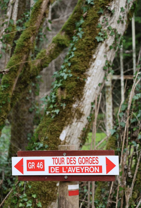
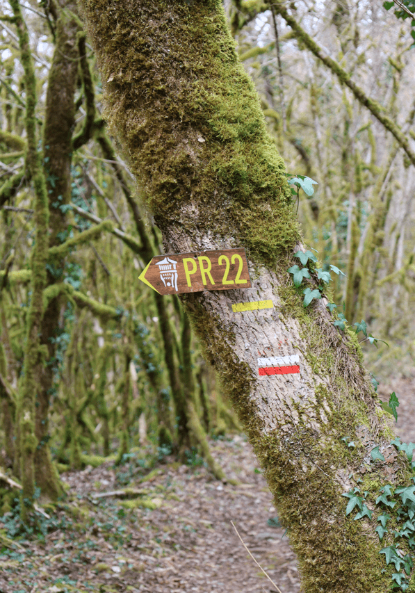
Circuit PR4 balisé en jaune

Stationnement

Hameau de Mordagne

Télécharger PDF Télécharger GPX
Difficulty
Easy
Duration
1h (1j)
Dist.
4.2 km
À proximité
Circuits à proximité

Points d'intérêts à proximité
Choice of background map

IGN map

Aerial photos / IGN

Slope map (IGN map)

Map 1950 / IGN

Staff map (1820-1866)

Open Street Map

Lat : 44.19305Lng : 1.78871
Coordonnées copiées
AlerteAlertes

the best trails for

Grandes Randonnées

Causses & Gorges de l'Aveyron and more specifically Caylus, Saint-Antonin and Laguépie are crossed by two GR (Grande Randonnée) routes. 

  • The GR 46 “Du Val de Loire aux bastides” (From the Loire Valley to the bastides)”, The 966km Grande Randonnée from the north of France to the south starts in Tours (Indre-et-Loire) and ends in Toulouse (Haute-Garonne), via Saint-Projet, Lacapelle-Livron, Caylus and Saint-Antonin. The 64km stretch between Saint-Projet and Saint-Antonin will take you to the Château de la Reine Margot, the medieval streets of Caylus and the charming Notre Dame des Grâces chapel.
  • Visit GR36 “From the Channel to the Pyrenees”, is a long-distance hiking trail 1400km, which also links the north and south of France. It is used by the Pilgrim's Way to Santiago de Compostela from Conques (Aveyron) to Toulouse (Haute Garonne). You have two options: take the train to Villefranche-de-Rouergue and follow the GR36 to Laguépie (38km, 2 days), or hike to Laguépie from Najac (21km, 5h00).
don't miss a thing

Topoguide

Saint-Antonin

Find out more about the 24 walks and hikes starting from Saint-Antonin in the SAVSA topoguide. Available from our 3 tourist offices.

don't miss a thing

Topoguide

Causses & Gorges

Discover the 34 walks and hikes in the Causses & Gorges de l'Aveyron region. Available from our 3 tourist offices.

don't miss a thing

Topoguide

Tarn-et-Garonne

Discover the 40 walks and hikes in the Tarn-et-Garonne guidebook. Available from our 3 tourist offices.

don't miss a thing

Hiking maps

La Symphorine

Find out more about the 5 Saint-Symphorien hiking trails. Available from our 3 tourist offices.

Our interpretation trails

Family walks and hikes

Are you looking for a walks for children ? One of our 4 interpretation trails is made for you. 

Interpretation trails are fun walking trails with a number of information panels to help you discover the environment. Below you'll find the booklets that will accompany you on your walk.

You can download them directly here or ask for them at one of our three tourist information offices!

don't miss a thing

Find your

Family outing

Error 404

Ce circuit ne se trouve pas dans ce widget.
Si vous en êtes le propriétaire veuillez vérifier votre filtrage.

Our natural sites

Looking for nature?