IGN map


L'Aveyron prend sa source près de Séverac-le-Château, dans le département de l'Aveyron et se jette dans le Tarn. Il a créé des gorges à partir de Villefranche-de-Rouergue jusqu'à Montricoux dans le Tarn-et-Garonne. Une grande partie de son lit est dans la faille géologique entre Causse sur la rive droite et Ségala sur la rive gauche, de Rodez à Laguépie environ. Le Pont de la Mécanique fut construit entre 1854 et 1858 lors du lancement de l'ambitieux programme de travaux publics qui consistait à développer le chemin de fer en France. Parcours avec 55% de route.
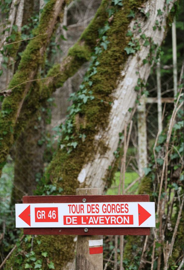
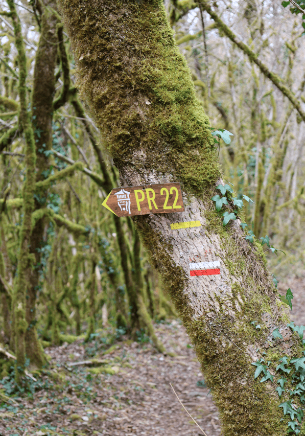
CIrcuit PR3 balisé en jaune
Place du Foirail
IGN map

Aerial photos / IGN

Slope map (IGN map)

Map 1950 / IGN

Staff map (1820-1866)

Open Street Map

Au départ de la place du Foirail, prendre la rue de la Mairie. À l’intersection, tourner à gauche en direction du
pont de l’Aveyron. Traverser la voie ferrée puis suivre la départementale 106b en direction de Najac. Après 350 m, bifurquer à droite au premier croisement pour prendre le chemin goudronné sur environ 2,2 km.
Blotti entre les bras de l’Aveyron d’un côté et du Viaur de l’autre, Laguépie relève d’une frange aveyronnaise qui fut rattachée au Tarn-et-Garonne par Napoléon Ier.
L’ancienne bourgade aurait pu appartenir aussi bien au Tarn qu’à l’Aveyron, puisqu’elle est limitrophe aussi de ce département!
Laguépie se révèle être un charmant village auquel la roche primitive donne la marque du Rouergue.
Les vallées étroites des deux rivières qui mêlent ici leurs eaux ont formé de profonds sillons aux versants recouverts d’une végétation dense, où dominent les chênes, mais surtout les châtaigniers qui donnent le fruit emblème de la commune (la châtaigne a même, à l’automne, son propre marché à Laguépie). Si de l’ancien complexe minier, qui fournissait autrefois le cuivre à l’artisanat auvergnat, ne subsistent que des éboulis, l’imposante ruine du château, elle, demeure, montant la garde sur le village.
Les principales activités de loisirs sont liées à la nature et à l’eau : baignade ou farniente sur la plage en bordure du Viaur, virées en canoë, location de VTT, circuits pédestres ou de cyclotourisme, pêche, tennis ou minigolf à la base de loisirs des Arènes…
A l'intersection, prendre à droite en direction de Lauressie sur 1,2 km. Après être entré dans le hameau de la Lauressie, au niveau d’une petite place, prendre à gauche le chemin en épingle. Après la mare, suivre le chemin presque en face entre la maison et le champ sur 200 m, puis virer à droite et descendre sur 1 km jusqu’aux berges de l’Aveyron.
Le château de La Guépie, témoin des guerres et reconstructions depuis l’an mil, est préservé par l'association Lou Viel Castel. Il s'anime chaque été avec visites et événements, offrant un voyage dans l’histoire locale.
Sa construction remonte sûrement avant l’an mil, comme beaucoup de châteaux forts dans notre région, c’est en 1175, qu’on retrouve la première trace écrite du seigneur de La Guèpie, Raymond Bernard. En 1212, Simon de Montfort chargé d’éradiquer l’hérésie cathare attaque le château de La Guèpie, qui est incendié et rasé, ainsi que le village. Sa position stratégique lui permis d'être réédifié. Le comte de Toulouse Raymond VII, devient seigneur de La Guèpie. Par héritage le château revient à sa fille, épouse d’Alphonse de Poitiers (frère de Louis IX), qui l’échange contre le château de Penne. Bernard de Penne devient seigneur de La Guèpie et débute alors la branche des Penne-Gourdon pour 3 siècles environ. La guerre de Cent Ans enflamme le Sud-Ouest, le Viaur devient une frontière entre le royaume de France et d’Angleterre. Le traité de Brétigny le remet aux anglais pour une trentaine d’années. Le 1er aout 1592, la ligue catholique du duc de Joyeuse, fait le siège du château, 70 hommes et le baron furent tués lors de cette attaque. Le château fût à nouveau rasé ainsi que le village. En 1598, l’édit de Nantes apporte la paix, et les seigneurs resteront protestants. C’est le frère du baron assassiné qui relève les ruines du château et lui donne son aspect résidentiel à la fin du XVIe siècle. La révolution sonne la fin du château, il fut pillé par les habitants de la région. Le baron de Freissinet réfugié en Suisse décède en 1796. Héritent alors ses deux fils Casimir et Louis. Casimir revient pour la première fois en 1827, il tient à conserver les ruines du berceau de ses aïeux et fait faire quelques travaux. Son frère Louis, en 1844 vend le château en entier à Raymond Maurel, mais Casimir fait casser la vente et le château est partagé en deux. Casimir conserve les ruines que l’on visite, cette partie représente à peu près ¼ de la superficie. L’autre partie est vendue. Dans les années 70 des pans de murs tombent, le descendant du baron n’étant pas en mesure d'assumer cette charge le donne pour le Franc symbolique à la mairie de St Martin Laguépie, actuellement propriétaire.L'association Lou Viel Castel oeuvre depuis, à son entretien, et lui redonne vie, l'été par diverses animations ponctuelles.Le château est ouvert pour les journées du patrimoine et à partir de mi-juillet aux environs du 20 août chaque année, grâce aux bénévoles de l'association. Visite théâtralisée par l'AGIT le premier mercredi du mois d'août à 21h
Venez découvrir la très belle aire de pique nique des berges du Viaur à Laguépie.
L'aire de pique-nique des berges du Viaur à Laguépie vous invite à profiter d’un cadre paisible au bord de l’eau, à deux pas du village et sous l’ombre majestueuse du château Lou Viel Castel qui domine les lieux. En été, des jeux gonflables installés sur la rivière ajoutent une touche ludique, parfaite pour les familles. Des tables de pique-nique sont également disponibles, offrant un espace convivial pour se détendre et savourer un repas en pleine nature.
A l'intersection, tourner à droite et suivre le chemin qui longe l'Aveyron. Il s’agit du chemin de Saint Cambraire qui ramène vers le village. Après être passé sous le pont de la mécanique (SNCF), prendre le chemin cimenté puis goudronné. Passer sous le pont et remonter au panneau «cédez le passage». Tourner à droite. Franchir le pont qui enjambe l’Aveyron. Après l’église, prendre à droite, la rue de la Mairie, pour retourner à la place du Foirail.
Les gorges de l'Aveyron sont célèbres et on y vient pour les activités sportives, culturelles mais aussi ces petits villages comme ici à Laguépie où se trouve une belle plage avec baignade surveillée au bord de cette rivière sauvage le "Viaur".
Au 2ème étage, la chambre Aveyron dite familiale comprenant 2 chambre avec une salle d'eau accessible pour les deux chambres. La 1er chambre comprend : 1 lit 160, armoire, console avec TV, deux chevets, plateau de courtoisie. La 2ème chambre comprend 2 lits 0,90 rapprochés avec également un console avec TV, deux chevets, penderie et espace tisanerie (senseo, bouilloire, boisson fraiche ). La Salle d'eau (douche à l'italienne, 1 vasque avec meuble de rangement, sèche cheveux est commune aux deux chambres.
Au 3ème étage découvrez la toute nouvelle chambre Viaur dans un esprit vintage industriel avec 2 lits 0,90 rapprochés, meuble avec TV, plateau de courtoisie avec petit réfrigérateur, climatisation. Salle d'eau privative à cette chambre avec sèche cheveux, sèche serviette, douche lavabo et wc.
Séjour au 1er étage pour les petits déjeuners ou en terrasse selon le temps.
Accès internet par wifi gratuit.
Table d'hôtes sur place sur réservation.