IGN map


Randonnée de longueur moyenne qui s’effectue sur terrain relativement vallonné, ce qui lui confère un caractère un peu sportif. Le paysage est typique de ce que l’on appelle, le terrefort : sorte de bocage édifié sur un sol marneux (la marne est une roche composée de calcaire et d’argile). En plus de Parisot, les hameaux de Cornerave et de Labadie (l’abadià : l’abbaye) apportent le charme des vieilles bâtisses ; vers Tarignou, de nombreux fossiles sont visibles (ammonites et plantes). Le Château Astorguié (privé) construit pour Jean de la Valette au début du XVIe, possédait un grand parc situé sous le château, utilisé pour la culture de la "rose centifolia", rosier hybride complexe. La Halle, mentionnée au XIIIe siècle, abrite des mesures dites de Parisot, utilisées pour les céréales ou les légumes secs. Trois damiers y sont gravés à l'entrée sur une dalle des murs de l'enceinte. Cette halle était utilisée autrefois pour les foires aux bestiaux et les festivités. Parcours avec 55% de route.
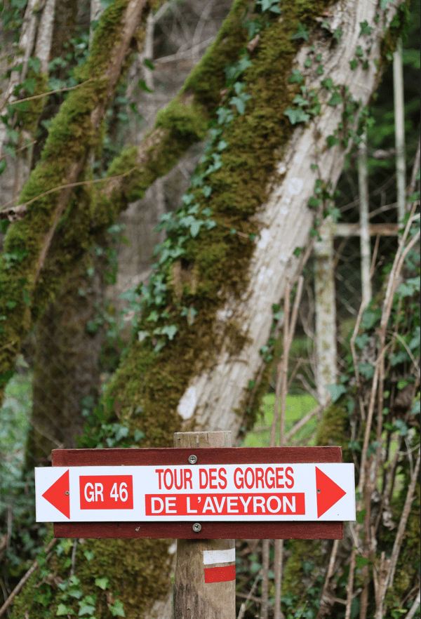
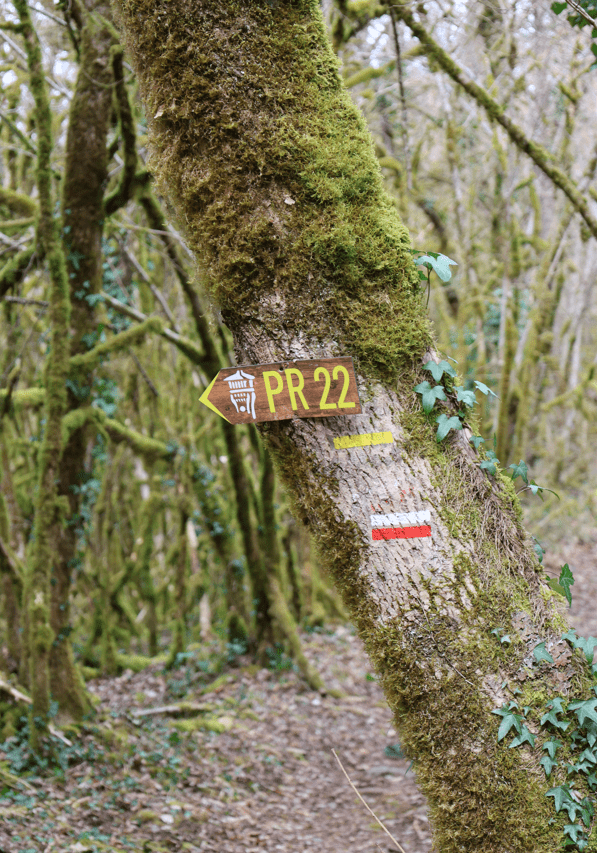
Circuit balisé en jaune
Place du Foirail
IGN map

Aerial photos / IGN

Slope map (IGN map)

Map 1950 / IGN

Staff map (1820-1866)

Open Street Map

Dos au Monument aux Morts, prendre à droite pour se diriger vers la D926.
Parisot est une commune rurale du Tarn-et-Garonne, en Occitanie, avec 559 habitants en 2022. Située dans le causse de Caylus, elle possède un riche patrimoine naturel et est traversée par plusieurs cours d'eau. Ses habitants sont les Parisotin(e)s.
Le village de Parisot, en France, se distingue par son riche patrimoine historique et ses charmants paysages. Développé autour d'un château médiéval, le village conserve des vestiges de son passé, tels que des maisons à pan de bois, une ancienne mairie, et une église paroissiale. La rue de la mairie, anciennement rue Droite, était l'axe commercial principal depuis le Moyen Âge. Parmi les sites remarquables, on trouve le château de l'Astorguié, associé à la famille Valette-Parisot, et un lac artificiel créé dans les années 1970, idéal pour la baignade et la pêche. Le village abrite également une halle reconstruite en 1881, un foirail historique, et un monument aux morts unique. Parisot est le lieu de naissance de Jean de La Valette-Parisot, grand maître des Hospitaliers de l'Ordre de Saint-Jean de Jérusalem, ajoutant une dimension prestigieuse à son histoire.
Au croisement, prendre la rue la plus à gauche. Dans le virage, se diriger sur le chemin en castine à droite. Après avoir traversé la ferme, poursuivre tout droit, traverser la départementale (Attention aux voitures). Continuer en face le chemin. À la route, tourner à gauche. Retrouver la D926, la franchir et poursuivre en face en direction de Garricgros.
Parisot picnic area
Parisot picnic area
Suivre le sentier, à l’intersection bifurquer à gauche.
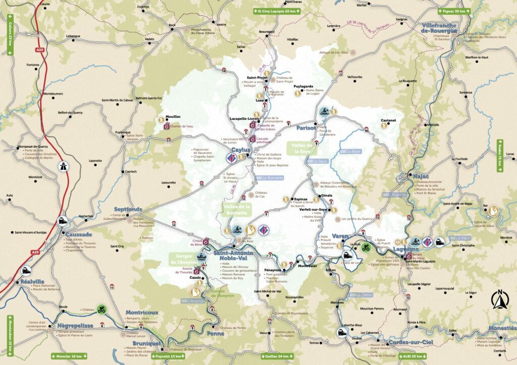
À 15 min de Saint Antonin, aux portes de l’Aveyron, le lac de Parisot vous accueille pour une journée nature. En été, profitez de la baignade surveillée, de l’Aquapark et de la location de paddle, pédalo et bien plus sur notre base de loisirs !
Le lac de Parisot est l’endroit idéal pour une journée de détente et d’aventure en pleine nature.
En juillet et août, profitez de la baignade surveillée dans une eau peu profonde, parfaite pour les enfants et la tranquillité des parents.
Envie de sensations fortes ? Testez l’Aquapark et ses structures gonflables avec sauts, glissades et défis palpitants ! Pour un moment plus paisible, optez pour la location de pédalos, paddles et autres équipements nautiques. Les plus jeunes pourront s’amuser en toute sécurité dans un espace ludique au sol, conçu spécialement pour eux.
Pour une pause rafraîchissante, la buvette de la base nautique vous attend avec boissons et planches apéros, les pieds presque dans l’eau ! Après une belle journée sur l’eau, prolongez le plaisir à la Guinguette Les Poissons Volants, ouverte tout l’été de 11h à 2h du matin. Installez-vous sur la terrasse ombragée sous le grand saule pleureur, savourez de délicieux plats et profitez de concerts en plein air.
Et pour les amoureux de nature, découvrez Parisot autrement grâce à 6 sentiers de randonnée adaptés à tous les niveaux. Entre forêts, collines et panoramas magnifiques, ces balades vous feront explorer la richesse du territoire.
Ne manquez pas l’incontournable marché gourmand tous les jeudis soirs en juillet et août ! Venez déguster de bons produits locaux dans une ambiance conviviale et festive, rythmée par des concerts live au bord du lac.
Que vous soyez en quête d’aventure, de détente ou de découvertes, le lac de Parisot vous promet une expérience inoubliable en famille ou entre amis !
À Tarignou, tourner à gauche. Dans le virage, obliquer à droite et emprunter le sentier jusqu’à la route. Traverser-la et poursuivre le sentier.
Nous vous proposons une activité de pleine nature à dos de petits chevaux ou poney.
Ici équitation rime avec respect.
Des groupes de niveau ou famille vous sont proposés.
Nous accueillons tous les publics.
Les balades se font en sous-bois (ombragés l’été) principalement.
Du débutant au confirmé venez partager un moment entre amis ou en famille.
Balade ½ journée ou journée.
Sur réservation.
Groupes de niveau :- en famille ou entre amis, en se mettant au niveau le plus bas- débutants : jamais fais ou peu.- moyens : sans galop ou découverte du galop- confirmés : sachant faire des trois allures de manière autonome.
Encadrement diplôme avec plus de 15 ans d'expérience.
Au carrefour suivant, continuer tout droit, traverser le Mas de Cazes. À l’intersection, s’engager à droite sur le chemin en castine. A la fourche, virer à droite en direction du Mas de Panis.
Au carrefour du Mas de Panis, poursuivre tout droit le chemin. À la route (attention route passagère). Continuer en face sur 200 m., la route descend légèrement, puis prendre le 1er sentier qui se trouve à côté gauche. Descendre tout droit et retrouver une route en fond de vallée. La prendre sur la gauche sur 450 m puis prendre le chemin qui part à droit et remonte. Après le virage en épingle, arrivée à une intersection, prende le chemin en face. Il aboutit à Cornerave, hameau typique du Quercy.
Suivre la route, passer le hameau de Labadie. À la première bifurcation, poursuivre tout droit, à la seconde, virer à gauche. Franchir le pont de la Seye. Arriver au panneau « Cédez-le-passage », au niveau de la D84 et s’engager à gauche. Dépasser la première maison sur la droite et emprunter le sentier.
Rejoindre la route, poursuivre sur la rue en face. Aux deux intersections, tenir la gauche sur la rue principale.
Arriver à la statue de la Vierge et tourner à gauche, rue de la Mairie. Passer la halle. À la hauteur du château de l'Astorguié, suivre la voie qui monte. Se diriger à droite vers l’église Saint-Andéol, puis à gauche, place de l’église, gravir l’escalier qui mène au belvédère (point de vue). Redescendre le chemin passant le long de l’église. Continuer tout droit, à la seconde intersection, tourner à gauche, rue du Belvédère, puis à droite, rue du Savoir. En descendant tout droit, retourner à la place du Foirail.