
PR1 Chemin du Lac - Parisot :

Parisot fut établi au Moyen-Age (961) sur le sommet d’une butte dominant le Causse. Du château primitif autour duquel s’est constitué le village ; il ne reste que quelques vestiges des fortifications: la Porte Génébrière, une tour. L’emplacement du castrum romain est situé au niveau du belvédère. Village natal de Jean de la Valette, Grand Maître de l'Ordre de Malte. Il a rendu la liberté aux habitants de l’ile de Malte. En son honneur, la capitale de l’ile porte son nom : Lavalette. Le lac de Parisot, est un lac collinaire créé en 1973 sur 9 ha. C’est un lac où l’on peut pratiquer la pêche (2è catégorie) et la baignade. Parcours avec 40 % de route
Balisage
Circuit PR1 balisé en jaune
Stationnement
Place du Foirail

IGN map

Aerial photos / IGN

Slope map (IGN map)

Map 1950 / IGN

Staff map (1820-1866)

Open Street Map

1
Etape 1
Au niveau de la croix de la place du Foirail, s’engager rue de la Mairie. Laisser la mairie sur la droite et prendre la première rue à gauche qui rejoint la D33.
Parisot
Parisot est une commune rurale du Tarn-et-Garonne, en Occitanie, avec 559 habitants en 2022. Située dans le causse de Caylus, elle possède un riche patrimoine naturel et est traversée par plusieurs cours d'eau. Ses habitants sont les Parisotin(e)s.
Le village de Parisot, en France, se distingue par son riche patrimoine historique et ses charmants paysages. Développé autour d'un château médiéval, le village conserve des vestiges de son passé, tels que des maisons à pan de bois, une ancienne mairie, et une église paroissiale. La rue de la mairie, anciennement rue Droite, était l'axe commercial principal depuis le Moyen Âge. Parmi les sites remarquables, on trouve le château de l'Astorguié, associé à la famille Valette-Parisot, et un lac artificiel créé dans les années 1970, idéal pour la baignade et la pêche. Le village abrite également une halle reconstruite en 1881, un foirail historique, et un monument aux morts unique. Parisot est le lieu de naissance de Jean de La Valette-Parisot, grand maître des Hospitaliers de l'Ordre de Saint-Jean de Jérusalem, ajoutant une dimension prestigieuse à son histoire.
2
Etape 2
Emprunter le premier chemin à gauche, dans le virage, puis prendre le sentier immédiatement à droite (partie commune avec le retour).
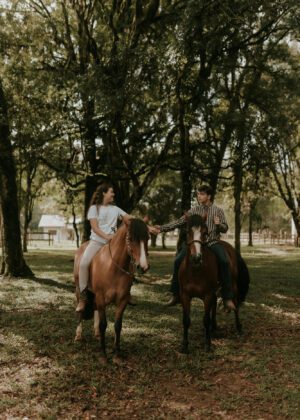
Lake Parisot
À 15 min de Saint Antonin, aux portes de l’Aveyron, le lac de Parisot vous accueille pour une journée nature. En été, profitez de la baignade surveillée, de l’Aquapark et de la location de paddle, pédalo et bien plus sur notre base de loisirs !
Le lac de Parisot est l’endroit idéal pour une journée de détente et d’aventure en pleine nature.
En juillet et août, profitez de la baignade surveillée dans une eau peu profonde, parfaite pour les enfants et la tranquillité des parents.
Envie de sensations fortes ? Testez l’Aquapark et ses structures gonflables avec sauts, glissades et défis palpitants ! Pour un moment plus paisible, optez pour la location de pédalos, paddles et autres équipements nautiques. Les plus jeunes pourront s’amuser en toute sécurité dans un espace ludique au sol, conçu spécialement pour eux.
Pour une pause rafraîchissante, la buvette de la base nautique vous attend avec boissons et planches apéros, les pieds presque dans l’eau ! Après une belle journée sur l’eau, prolongez le plaisir à la Guinguette Les Poissons Volants, ouverte tout l’été de 11h à 2h du matin. Installez-vous sur la terrasse ombragée sous le grand saule pleureur, savourez de délicieux plats et profitez de concerts en plein air.
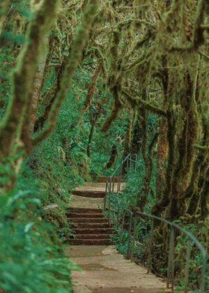
Et pour les amoureux de nature, découvrez Parisot autrement grâce à 6 sentiers de randonnée adaptés à tous les niveaux. Entre forêts, collines et panoramas magnifiques, ces balades vous feront explorer la richesse du territoire.
Ne manquez pas l’incontournable marché gourmand tous les jeudis soirs en juillet et août ! Venez déguster de bons produits locaux dans une ambiance conviviale et festive, rythmée par des concerts live au bord du lac.
Que vous soyez en quête d’aventure, de détente ou de découvertes, le lac de Parisot vous promet une expérience inoubliable en famille ou entre amis !
3
Etape 3
Au croisement, continuer tout droit. Arriver au lac et poursuivre tout droit. (Il y a une aire de jeux
et une aire de pique-nique, si on part sur la gauche ). Au niveau de la guinguette, tourner à droite.
Après quelques mètres, se diriger vers la gauche en longeant le lac. Prendre à droite avant le camping, puis
tourner à gauche sur la D84.
Guinguette Les Poissons Volants
Dès l'arrivée des beaux jours, venez profiter d'un cadre exceptionnel au bord du lac de Parisot !
Les Poissons Volants vous proposent une restauration basée sur des produits frais, de saison et autant que possible locaux !
Mais ce n'est pas tout ! Ce lieu convivial organise également des concerts tous les jeudis soirs de juillet/août en même temps que les marchés gourmands organisés en partenariat avec les producteurs locaux. D'autres concerts seront également organisés aux moments "clés" de l'été (Fête de la musique, 14 juillet, 15 août).
Ne manquez pas de vous y arrêter si vous êtes dans les environs ! Ouvert du 2 mai au 12 septembre cette année, les Poissons Volants vous accueillent tous les soirs ainsi que les samedis et dimanches midis. Accueil des groupes sur réservation, chaises bébé disponibles, terrasse agréable et vente à emporter. Pensez à réserver en pleine saison ! Et suivez leur actu sur les réseaux !
4
Etape 4
Suivre la départementale sur 300 m, tourner à gauche et prendre le sentier. À la route, poursuivre sur la gauche et continuer tout droit jusqu’à la seconde intersection. Se diriger à gauche en direction de la Rocarie.
Camping du Lac de Parisot
Le camping du lac de Parisot ** est situé dans un cadre frais et agréable au bord du lac.
Profitez des baignades dans le lac ou dans la piscine, du terrain de pétanque, des tables de ping-pong, de la Guingette ainsi que de l'aire de jeux pour les enfants et l'aire de barbecue directement présents sur le camping.Retrouvez également un grand nombre d'activités de plein air comme le canoë, la pêche, le basket et bien d'autres surprises. Au total il s'agit de 5 mobil-homes, 26 emplacements campings et un chalet disponible à la location.
5
Etape 5
Laisser la route sur la droite et continuer tout droit sur le chemin carrossable qui se transforme en
route.
Parisot picnic area
Parisot picnic area
Parisot picnic area
6
Etape 6
Après 1900 m, avant le terrain de football, emprunter le sentier sur la gauche. Continuer tout droit. À l’intersection, poursuivre tout droit. Au carrefour, (commun avec le point 3), tourner à droite, puis à gauche.
7
Etape 7
A la route, suivre le sentier en face. Après quelques mètres, au carrefour, poursuivre la voie centrale. Aux deux intersections suivantes, tenir la gauche sur la rue principale.
8
Etape 8
Arriver à la statue de la vierge et tourner à gauche, rue de la Mairie. Passer la halle. À la hauteur du château, suivre la voie qui monte. Se diriger à droite vers l’église Saint-Andréol, puis à gauche, place de l’église, gravir l’escalier qui mène au belvédère (point de vue). Redescendre le chemin longeant l’église. Continuer tout droit; à la seconde intersection, tourner à gauche, rue du Belvédère, puis à droite, rue du Savoir. En descendant tout droit ; retourner au point de départ.