LAGUÉPIE PR9

Rives et coteaux du viaur

the dead end opposite the fountain. At the cross, turn right and follow the lane to the fulling mill. Make a U-turn to return to the calvary and continue straight ahead to reach the confluence of the Viaur and the Aveyron, overlooked by the castle of Saint-Martin-Laguépie.

go under the bridge. Go up the rue du Viaur; at the sign "cédez le passage" turn right into the rue du 19 mars, then take the first alley on the right, the "Cantou del Marrot" for 100 m. Turn left and follow the Viaur. Continue straight ahead on the path that crosses the campsite. At the end of the campsite, follow the road to the right along the Viaur. After 100 m, pass the white water kayak course on the right.

 then turn left onto the path which curves upwards towards "les Cazals" and which becomes a dirt track. At the end of the path, turn left. At the next intersection, go straight on until you reach the road.

 cross the D922, go down about 450 m and then turn right onto the dirt track that leads to La Taillette.

Follow the road to the left leading to the D922, cross the road and turn right for 350m. Take the first road on the left after the sign for the village of Laguépie and follow it until you pass the cemetery. Continue on the path on the right which runs alongside the cemetery. Turn left to go back down along the D922.

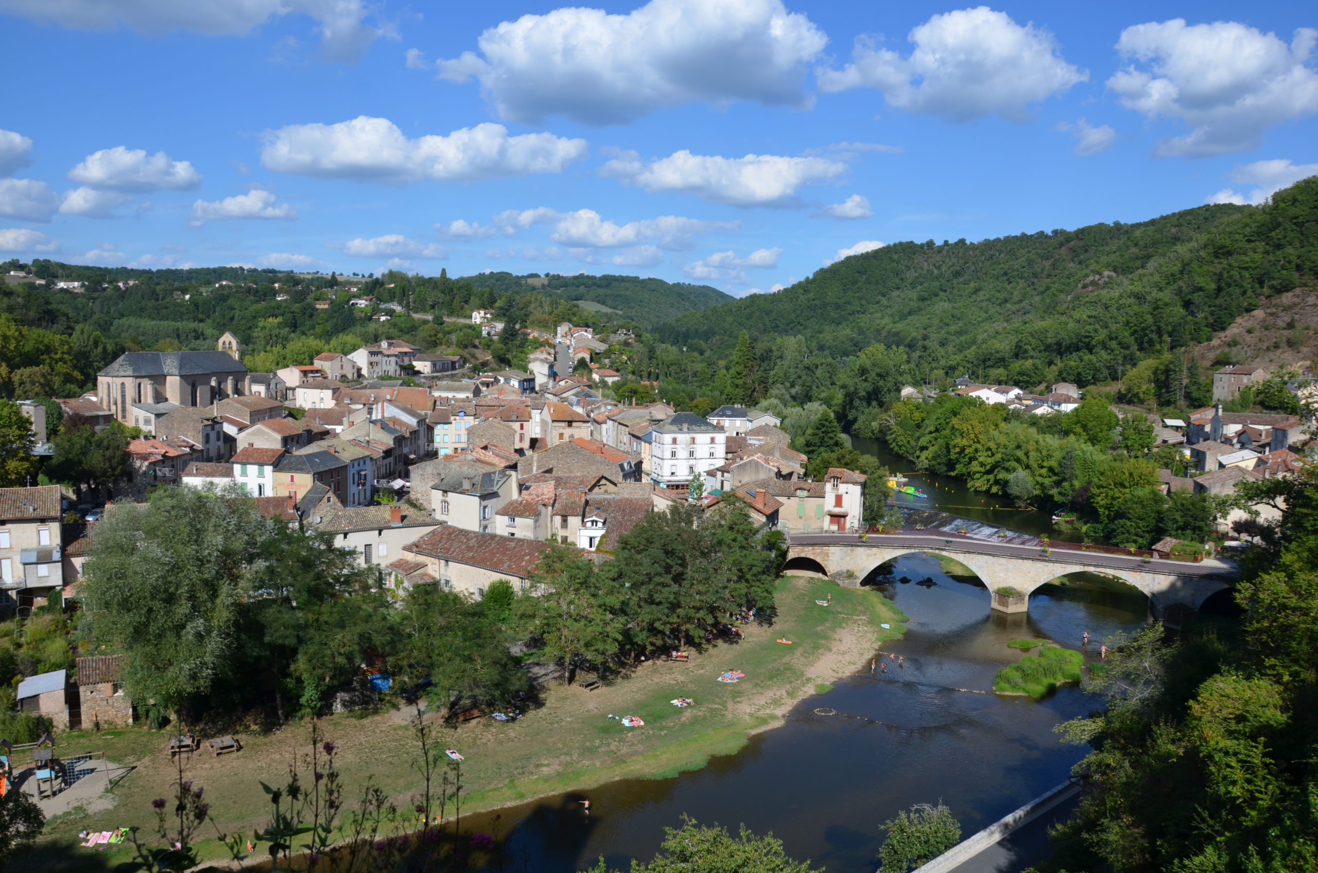
Take the path on the right that climbs towards the Puech-Haut. At the highest point of the path, go back and forth a few meters on your right to arrive at the Puech-Haut, which is a viewpoint on the Aveyron but also the site of the old chapel of Saint Amans. Continue along the path on the right, cross the road to take the Rue de la Mairie and then return to the Place du Foirail.

Descend towards the village along the steep path, slippery in wet weather (take care to use the ladder), which winds its way down to the housing estate. Turn left onto the road that leads back to point 2.

WP GPX Maps Error: GPX file not found! /home/caussej/www/wp-content/uploads/gpx/laguepie PR 9.gpx
Download file: laguepie PR 9.gpx

TRAIL INFO

The arduous ascent via the Camin Roudanès to the top of the Deymié is rewarded by a magnificent panorama of the Aveyron gorges and the Roc d'Anglars.

practical information

Situations:

practical information

Laguépie
24 km from Saint-Antonin-Noble-Val

PArking:

Place du Foirail

To discover

The Viaur is a left-bank tributary of the Aveyron. The Viaur owes its name to the Romans, who once called the river Via aurea, "the way of gold". Over time, this became Viaur. 

en_GBEnglish (UK)
Search
Close this search box.